D.3. Forests
Brief description:
the indicator shows the total forest stock area, forest-covered area, forest cover of the territory at the country; forest area by category (forest area designated for protection, for production, for recreational purposes and for the conservation of biodiversity)
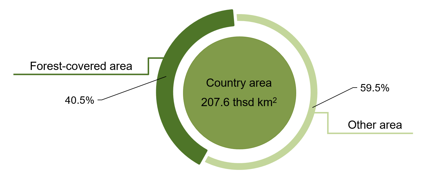
Structute of the lands area of the Republic of Belarus in 2025
(percent)
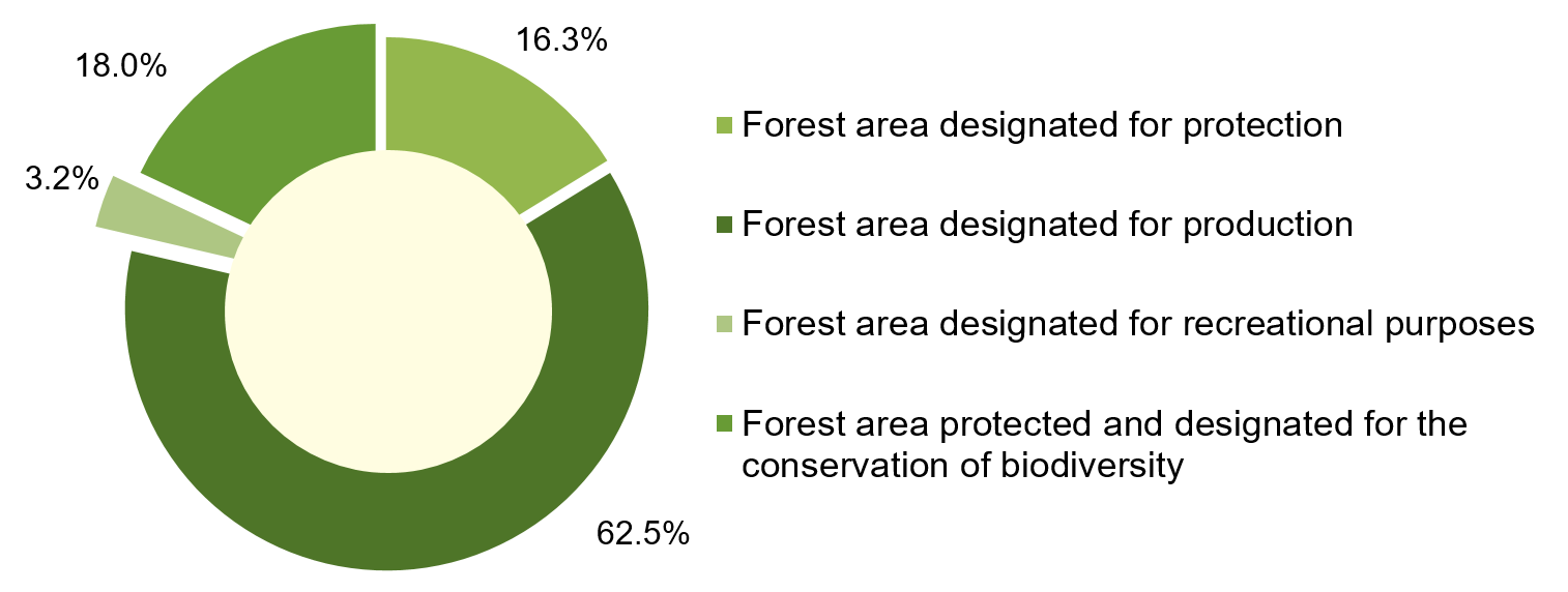
Structute of the forests area by category of the Republic of Belarus in 2025
(percent)
Methodology:
the total forest stock includes:
• forests growing on the forest stock land and other lands, and forest-covered area;
• forest land not covered by forests, and non-forest land within the boundaries of the total forest stock land and other lands designated for forest management;
forest-covered area is the forest stock area covered by tree vegetation, either naturally growing or planted, and shrubs;
forest cover of the territory at the country is a ratio of the forest-covered area to the total land area of the country (region, district);
forest area designated for protection comprises forests within the boundaries of water protection zones; forests within the boundaries of the first and second lines of sanitary protection zones of drinking water sources and supply systems; forests within the boundaries of 100-meter-wide strips on either side of the last public railway / highway;
forest area designated for the conservation of biodiversity comprises forests within the boundaries of protected areas; forests within the boundaries of habitats of wildlife species listed in the Red Book of the Republic of Belarus, handed over for protection to users of land sites and/or water bodies under the procedure established by the Council of Ministers of the Republic of Belarus; forests within the boundaries of typical and rare natural landscapes and biotopes handed over for protection to users of land sites and/or water bodies under the procedure established by the Council of Ministers of the Republic of Belarus;
forest area designated for recreational purposes comprises forests within the boundaries of cities (urban forests); forests within five-kilometer, two-kilometer, 500-meter, 100-meter wide strips from the boundaries of Minsk, regional centers, cities of regional subordination, and other settlements respectively, as well as horticultural partnerships and cottage cooperatives, unless otherwise stipulated by urban development projects approved by the President of the Republic of Belarus; forests within 200-meter wide strips from the boundaries of land sites where sanatoria, rest homes, boarding houses, health camps, tourist camps and other medical, sanatorium and health facilities are located;
forest area designated for production comprises other forests
Data source:
administrative data;
the data producer is the Ministry of Forestry of the Republic of Belarus
Relevance of the indicator:
the indicator provides a measure of the state of forests in the country and shows trends in its uses and its protection